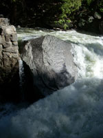
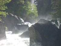
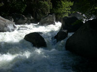
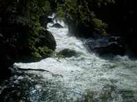
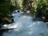
These falls are fed by the Merced River as it enters the valley from the southeast. For the most part, the valley is laid out east to west. At the eastern end, however, it is divided by Half Dome with the valley continuing northeast and southeast. It is in this southeast region that one can view the falls. From Happy Isles one can follow a semi-steep path up to the falls. The first sighting of the falls can be made as the path crosses the Merced a good distance below the base of Vernal Fall. The path continues on up to a great view from the top of that fall. Some distance further up the path is Nevada Fall. I only got as far as the bridge so I’ll stick with a description of that view. This is the same river that thunders past Happy Isles. Here the sound is even louder. The water is moving swiftly after its plunge down Vernal Fall and continues a relatively steep decline. At the bridge the river makes a short plummet down. These drops continue most of the way to Happy Isles. The boulders bear the punishment of whitewater on its brisk pace. I may have not made it to a better place to view Vernal Fall but was sufficiently awestruck by what I did see. The view is spectacular and one can really feel the power of nature.